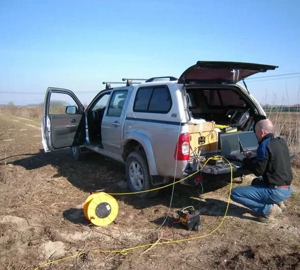
The subsurface contrast between Wellington's CBD and the hill suburbs is stark. The reclamation fill along Lambton Quay bears little resemblance to the weathered greywacke of Kelburn. Seismic tomography maps this transition. Refraction and reflection profiles delineate the interface between artificial fill, colluvium, and bedrock. The Wellington Fault runs through the city core. Its influence on rock mass quality is not uniform. Our team runs P-wave and S-wave lines to capture velocity contrasts that correlate directly with rippability and stiffness. For deeper targets, we pair reflection spreads with MASW to constrain shear-wave velocity profiles in the upper 30 metres. The method serves projects from foundation design to landslide assessment in a city where geology changes block by block.
A P-wave velocity jump from 800 m/s to 2,400 m/s typically marks the colluvium-to-bedrock interface in Wellington's hill terrain.
Common questions
How long does a seismic tomography survey take on a typical Wellington section?
A single 115-metre refraction line with 24 geophones takes about two hours of field time, assuming pedestrian access and a sledgehammer source. Larger spreads or rope-access terrain add setup time. Data processing and interpretation require an additional two to three working days for final deliverables.
What is the cost range for a seismic survey in Wellington?
Seismic tomography surveys in the Wellington region range from NZ$4,940 to NZ$9,860 depending on the number of spreads, depth of investigation required, and site access complexity. Steep sites requiring rope crews fall at the upper end of the range.
Can seismic methods identify the Wellington Fault on a building site?
Yes, with the right line orientation. High-resolution reflection profiling can image fault splays and offset reflectors if the survey line crosses the feature at a high angle. The crushed rock within fault zones produces a distinct low-velocity anomaly on refraction tomograms. NZGS guidelines recommend combining seismic data with trenching or boreholes for fault avoidance studies on critical structures.